New bridge beams in place as part of Otiria-Moerewa floodworks
25 Jul 2023, 11:54 AM
The development of the Otiria and Moerewa flood scheme has reached a significant milestone with the successful placement of bridge beams on the new 60-metre span bridge.
The Pokapu Rd, Otiria bridge, which is a central component of the flood mitigation project, is poised to better protect the communities of Otiria and Moerewa from the adverse impacts of flooding.
Construction of the bridge – underway on multiply-owned whanau land with the blessing of its shareholders – began in January after a dawn blessing ceremony late last year.
Northland Regional Councillor Geoff Crawford says an important turning point in the project was achieved recently when the first of the 15 sturdy beams, weighing approximately 25 tonnes each, was carefully craned into place.
Councillor Crawford, who chairs the area’s Taumarere Flood Mitigation Working Group, says the beams, meticulously positioned with a 10-millimetre tolerance between each one, form an integral part of the new bridge. Traversing three spans, the beams have been arranged in five rows, showcasing the emerging structure to the community.
He says the overarching aim of this project is to restore the Otiria Stream to its natural flow, which was impeded decades ago due to the construction of Ngapipito and Pokapu Roads and Otiria’s railroad embankment.
The unique geographical characteristics of the area, with ancient lava flows beneath Otiria and Waiharakeke, have presented an unusual scenario. In a one-in-100-year flood, approximately 70 percent of the Otiria Stream's flow and 80 percent of the Waiharakeke River's flow would traverse the associated floodplain, unlike the usual scenario where the majority of a river’s floodwaters would be contained within its riverbanks.
“The Waiharakeke River falls off the lava flow at Pokapu Rd into a series of waterfalls and over the years has carved out a massive canyon increasing the cross-sectional area from just 36 square metres at Pokapu Rd to more than 600 square metres at Otiria Marae.”
Councillor Crawford says the local community had several years ago come up with the idea of returning the water to its natural flow (as it was before any built infrastructure) and into an area historically much better able to cope with the large volumes of water which floods involved.
“The successful placement of the bridge beams signifies a remarkable step forward in the Otiria and Moerewa flood scheme.” “The emerging bridge structure serves as a testament to the collaborative efforts of various stakeholders and provides the community with a tangible glimpse of what the new bridge will look like.”
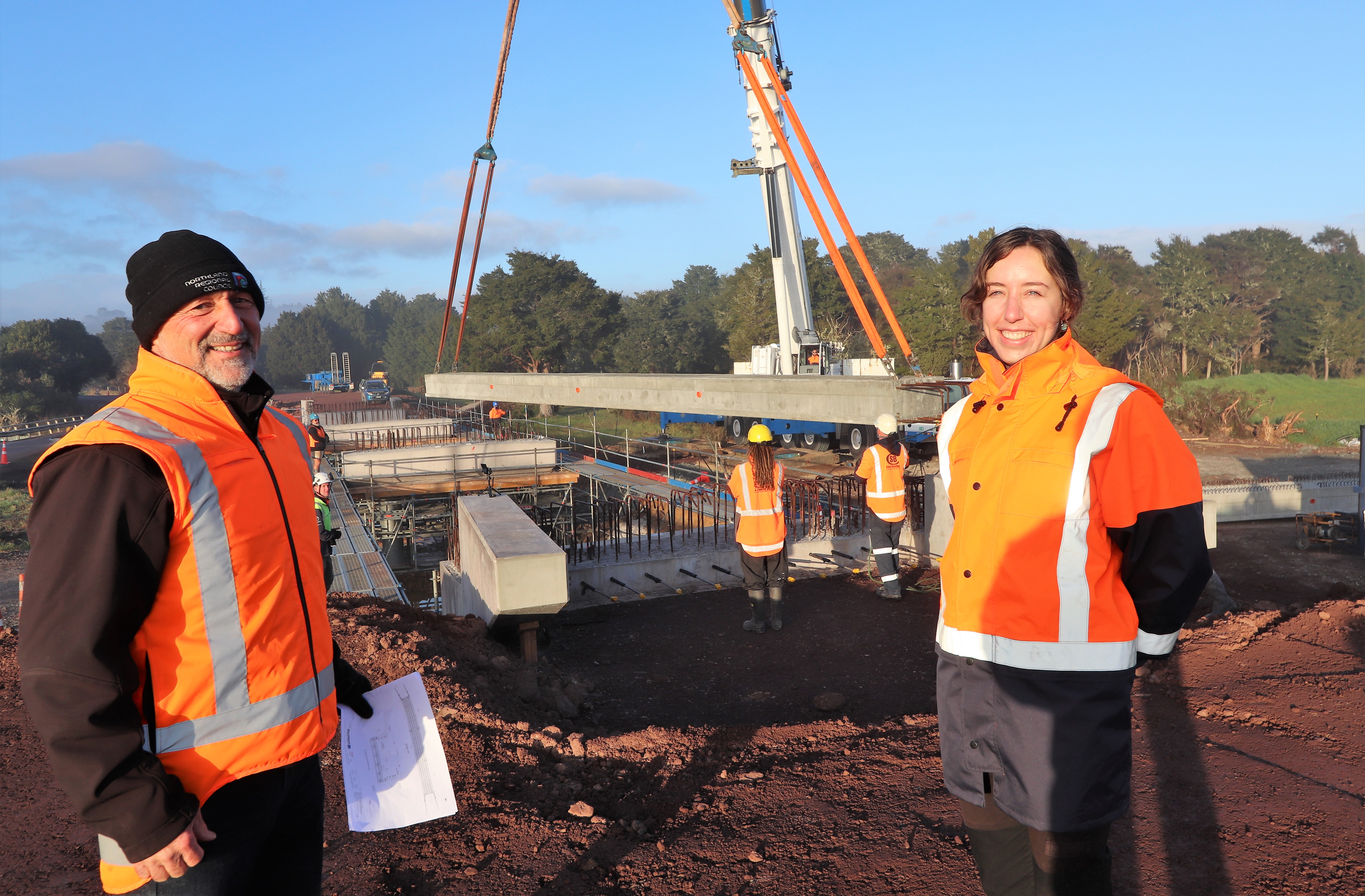
Northland Regional Council Rivers and Natural Hazards Manager Joseph Camuso and Rivers Project Manager Meg Tyler at the site of the new Pokapu Rd bridge as the first of 15 roughly 25 tonne beams is craned into place recently.
As part of the project the Northland Regional Council has been working on a staged plan with the local community, the Taumarere Flood Mitigation Working Group, local marae, Ngati Kopaki and Ngati Te Ara kaumatua, kuia and kaitiaki, the Far North District Council and Kānoa - Regional Economic Development & Investment Unit.
The project is part of the Resilient River Communities Programme. In 2020, Kānoa released $211m to co-fund 55 projects, collectively known as the Resilient River Communities projects, with regional and unitary councils.
Resilient River Communities is a joint initiative between Kānoa - the Regional Economic Development & Investment Unit, regional councils and local authorities focused on developing and upgrading vital river management and flood protection schemes in Aotearoa. (More information about these projects can be found online at www.resilientrivers.nz )
Stage I of the Northland project – construction of the downstream section of new $1.4 million 80-metre-long spillway at Otiria – was completed last year. (Flood infrastructure is completed from downstream to upstream.)
Stage II – due for completion before Christmas this year – will see the replacement of an existing 18-metre-long road bridge with the new 60-metre structure, and effectively triple the flow of floodwaters which can pass beneath it.
In previous floods this water would typically be diverted – in part by the existing bridge structure and railroad – downstream to land at Otiria and Moerewa.
A final and third stage is being carried out at the same time as work on the bridge and involves excavation of the remaining 800-metres of spillway and the eventual removal of the existing Pokapu Rd road bridge.
The works cumulatively mean that in a flood, most water will be sent down the new spillway and into the Waiharakeke River past the lava flow, where the river is considerably wider and deeper.
While floods will still occur, parts of the area currently subjected to potentially damaging and life-threatening half-metre deep floodwaters should see that reduced to just ankle height instead.
The $7M total cost of the project is being funded 60 percent by Infrastructure Reference Group funding, delivered by Kānoa with another eight percent met through targeted local Northland Regional Council rates, 19% through regionwide NRC rates and 13% ($1M) from the Far North District Council’s Better Off Fund.
The new single-lane bridge and an associated footpath is being built by contractors Ventia.
The project has also seen two kaitiaki employed as cultural monitors during the construction which was considered essential due to the rich Māori history and high number of sites of significance in the area.