Advance work begins ahead of $15M Awanui flood upgrade
22 Aug 2018
A drone has been used to survey 2.4 kilometres of the Awanui River flood scheme ahead of a planned $15 million Northland Regional Council upgrade.
The extensive, seven-year upgrade – designed to significantly boost flood protection in and around Kaitaia – is one of several key projects at the heart of the council’s new Long Term Plan (LTP) 2018-2028.
The scheme is designed to protect urban Kaitaia in a ‘once in a century’ type flood and a 1:20 year event in surrounding rural areas.
Te Hiku constituency representative Mike Finlayson says the scale and cost of the Awanui works means the upgrade proper will be carried out over several years from 2020 to 2027.
However, some preliminary and/or previously scheduled work – including the drone survey, stopbank repairs behind the Te Ahu centre and initial clearance for a new spillway near Bell’s Hill slip – will be carried out over the next few months.
He says as well as the drone survey – data from which will be used as part of the detailed design for the scheme – the council expects to have completed the other tasks by the end of the coming summer.
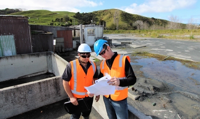 Regional council River Management Officer Matt Jolly, left, and colleague, River Management Engineer Barney Brotherhood, at the former concrete works site in Kaitaia with the Bell’s Hill slip site behind them.
Demolition and other work to clear the former 14,600 square metre Firth concrete plant site (which the council bought recently for roughly $650,000) is largely complete and the site will begin a new life as an emergency spillway beneath the Bell’s Hill slip later this year.
Councillor Finlayson says the council has been monitoring and managing the slow-moving slip site for many years, concerned it could potentially slip into – and block – the nearby Awanui River.
Meanwhile, he says early in the New Year, council contractors will begin about $300,000 of works to stabilise a roughly 500-metre stretch of deteriorating stopbanking behind the Te Ahu centre.
He says the regional council has been methodically working its way through the highest priority repairs needed by the decades-old scheme and the new works programme would bring much-need improvements, as well as future-proofing it for many years to come.
“As far as the scheme improvements proper are concerned, future flood risks will be mitigated largely through extensive modifications and improvements to stabilise existing stopbanks, which will allow the river to carry up to 15 percent more floodwaters.”
Councillor Finlayson says without the protection the upgrade would offer, a 1:100-year flood in urban Kaitaia could cause tens of millions of dollars in damage and put lives at risk.
Thirty percent of the new works will be funded locally via a roughly 60% increase to the existing targeted Awanui River Management Rate. However, the bulk – 70% – will funded by ratepayers Northland-wide via a new regional flood infrastructure rate consulted on through the council’s LTP process.
The 70/30 spilt means that for roughly $7 per ratepayer across the region, schemes like Awanui become much more affordable at a local level for those communities protected by existing (and aging) flood infrastructure work.
“The spilt also reflects the wider regional benefits from having Northland’s main service hubs better protected from flooding,” Cr Finlayson says.
Northland-wide, millions of dollars’ worth of major new flood works planned under the new LTP will be repaid over 60 years. That will spread the cost over the multiple generations that will benefit from it and at the same time make the work more affordable for smaller communities.
The council will engage with the wider Kaitaia community before and during the Awanui scheme upgrade, and will also continue to work closely with the Awanui River Flood Management Working Group.
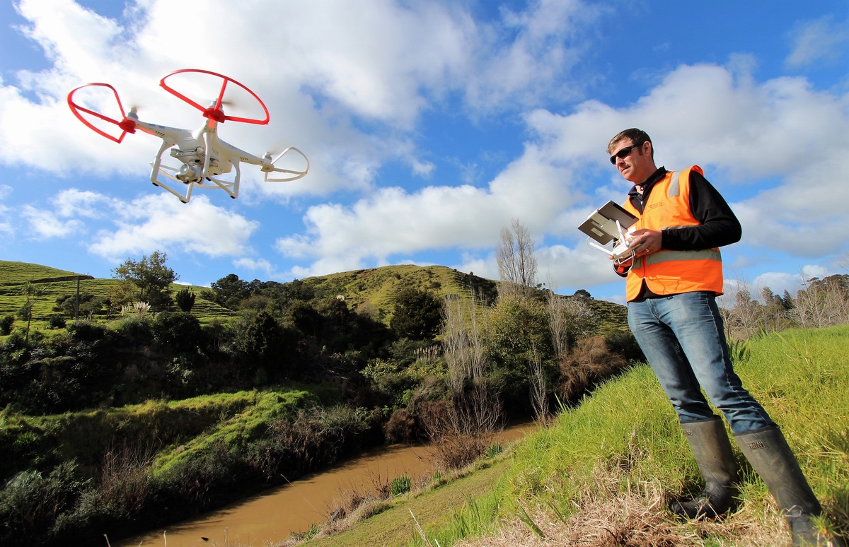
Regional council River Management Engineer Barney Brotherhood begins a drone survey of the Awanui flood scheme. He’s standing atop a stopbank beside the Awanui River, discoloured after recent rain, with the Bell’s Hill slip site behind.