Hydrographic survey data
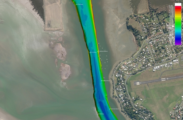
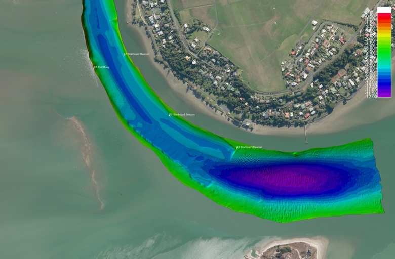
The Hydrographic survey of Mangawhai entrance was carried out by the Harbourmaster’s Office in December 2024.
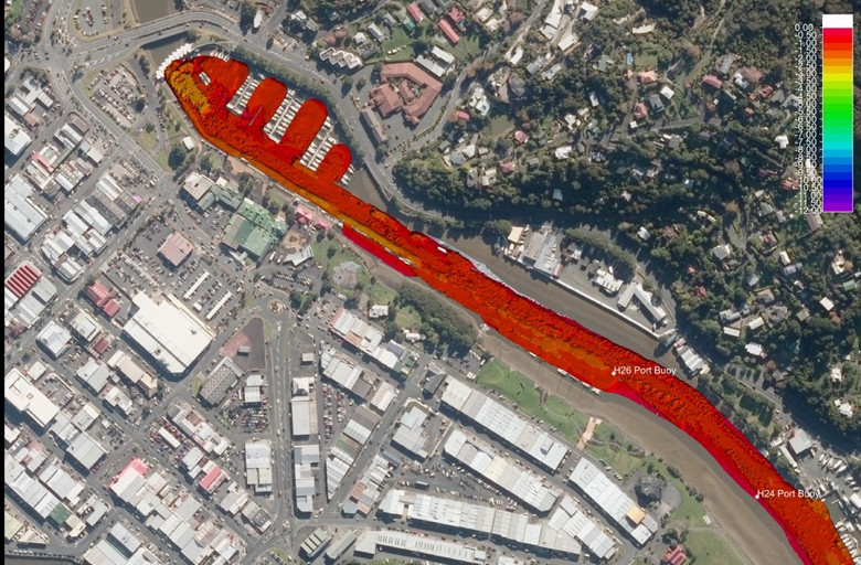
The hydrographic surveys of the the Hātea and Kioreroa Reach channels were completed in 2020.
The hydrographic surveys for Kerikeri Inlet were carried out in September 2017.
Hātea and Kioreroa Reach channels, and Kerikeri Inlet surveys were completed by Discovery Marine Limited, to the latest survey standards. They are provided for information only.
The depths details are at Chart Datum, so are the lowest expected soundings during normal atmospheric and tidal conditions. Predicted tide height should be added to these soundings to provide the water depth.
Note that both these areas are subject to sedimentation, so soundings and associated banks can change and move over time, and particularly after heavy rain events.
Mangawhai Entrance - December 2024
- Hātea River and Whāngarei Wharves 2020 Data - Sheet 1 (PDF, 1.2MB)
- Hātea River and Whāngarei Wharves 2020 Data - Sheet 2 (PDF, 1.4MB)
- Hātea River and Whāngarei Wharves 2020 Data - Sheet 3 (PDF, 1.6MB)
- Hātea River and Whāngarei Wharves 2020 Data - Sheet 4 (PDF, 2.1MB)
- Hātea River and Whāngarei Wharves 2020 Data - Sheet 5 (PDF, 2.6MB)
- Hātea River and Whāngarei Wharves 2020 Data - Sheet 6 (PDF, 2.6MB)
- Hātea River and Whāngarei Wharves 2020 Data - Sheet 7 (PDF, 3.4MB)
Hātea River post-dredge survey report
- Report - Hātea River-Post Dredge Survey - July 2020 (PDF, 1.3MB)
The log identified by K27 has been resurveyed and the log is no longer present there. It's presumed it has washed further down the harbour, possibly out to sea.
Hātea post-dredge images 2020
Go to these post-dredge images in PDF format (higher resolution) below.
 2 Bridge North 2
 3 Bridge To Kissing Point 2
 4 Marina To Whangarei Wharves 2
 4 Whangarei Wharves Mid 2
 4 Whangarei Wharves Nth 2
 4 Whangarei Wharves Sth 2
 5 Slipway Nth 2
 6 Onerahi Nth 2
 6 Onerahi Sth 2
 DML 2019Vs2020 Difference 1 2
 DML 2019Vs2020 Difference 2 2
 Dredging At H13 2
 Dredging At K22 2
 Dredging K31 Sth 2
 Kissing Pt Dredging 2
 Log Location
 Log Plan
 Log Profile

Hātea post-dredge images 2020 - PDF format
|
|
Kerikeri Inlet - September 2017
- Kerikeri Inlet survey coverage (PDF, 327KB)
- Kerikeri Inlet 2017 data - sheet 1 (PDF, 1.9MB)
- Kerikeri Inlet 2017 data - sheet 2 (PDF, 1.4MB)
- Kerikeri Inlet 2017 data - sheet 3 (PDF, 2.9MB)
