Natural hazards
Northland is subject to a number of natural hazards which, because of the pattern of development within the region, may place human life, property and/or economic production at risk.
These natural hazards include inundation (this includes both storm-related coastal events and tsunami as well as high intensity rainfall events) and other weather hazards, earthquakes, landslides, fire and volcanic activity (Beetham et al: 2004).
The operative Regional Policy Statement for Northland details council and community objectives for each natural and physical resource in our region. The objective relating to natural hazard management is:
• To avoid or mitigate the adverse effects of natural hazards by minimising and where practicable, avoiding the risk to life and damage to property, infrastructural services and other aspects of the environment, from natural hazard events.
The following are the anticipated environmental results after the implementation of the policy for hazard management in the operative Regional Policy Statement for Northland:
• Increased public awareness of the risks of natural hazards and their exposure to them.
• A reduction in the damage caused to the environment by significant natural hazards.
• A reduction in the damage caused to the environment by inappropriate protection works.
Tsunami
Tsunami hazard
Tsunami is a natural phenomenon that results when a large volume of water is displaced causing a series of waves to be generated, most commonly due to earthquakes that cause sea floor displacement. Tsunami can devastate coastal communities causing inundation, strong currents, contamination and other effects.
Historic records show that New Zealand has been affected by more than 40 tsunamis in the last 150 years. Four moderate tsunami inundation events have impacted Northland's east coast in the last 150 years. The prehistoric record indicates at least one large event, or a series of large closely-spaced events, has affected Northland's coast in the last 600 years.
Tsunami risk and consequences
Tsunami hazard is considered a high risk for Northland, especially among coastal communities. A generalised tsunami hazard-risk model for Northland indicates that a moderate hazard and risk exists for most of the northwest and east coast, a high hazard and moderate risk for the north, and a low hazard and risk for the west. The hazard is largely a function of tsunami source, intensity and return period.
Tsunami have the potential to cause loss of life, destruction of coastal property and infrastructure, erosion, environmental damage and economic impacts. Tsunami modelling for Northland indicates that the principal threat is from ruptures along the southern part of the Tonga Kermadec Trench. Such events are understood to be very rare, with reoccurrence intervals measured in thousands of years.
Tsunami risk management
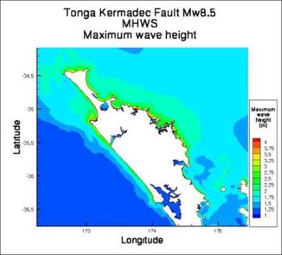
Computer inundation modelling has been undertaken by NIWA for 30 Northland coastal settlements based on earthquakes on the South American coast and the Tonga Kermadec trench (Figure 29).
The inundation mapping shows the predicted extent, depth and velocity of tsunami flows at these settlements.
These results are available on the Northland Regional Council website (www.nrc.govt.nz/civildefence), and can be used to inform planning for future land use and thereby mitigate the potential risk from tsunami.
Community response plans have been developed in high-risk areas and a number of communities in Northland also have tsunami warning sirens. Tsunami evacuation maps have also been produced by GNS Science for the entire Northland coastline, which show evacuation areas in the event of an earthquake or a tsunami warning.
Figure 29: Maximum water surface elevations for a Tonga-Kermadec subduction zone scenario at mean high water spring based on computer modelling
Tectonic activity
Northland has the lowest earthquake risk in New Zealand. No active faults are mapped within the region, and the whole Northland peninsula is generally regarded as tectonically stable. The recorded earthquakes have generally been small in magnitude and are seldom felt.
As well as ground-shaking, earthquakes can result in fault rupture, liquefaction, landslides and tsunami. The main earthquake risk to Northland is likely to be associated with the generation of tsunami referred to above.
For urban Whāngārei, there is an estimated mean return period of 1000 years for an earthquake of six on the Modified Mercalli scale, and 7000 years for an earthquake of seven on this scale, compared with nine and 42 years respectively for Wellington (Beetham et al: 2004). Intensities of six or more are those which may cause damage to some buildings.
A national reporting system helps identify likely impact areas and response to these events is covered by Civil Defence plans and procedures.
Flooding
Flood hazard
Flooding is the most frequent natural hazard that affects Northland, threatening human life, disrupting communications and access, damaging property and reducing primary production.
Northland's northerly geographical setting exposes the region to ex-tropical cyclones that have the potential to cause damage through heavy rain, such as in cyclones Bola and Fergus, and more recently Wilma (January 2011). Northland has, on average, one ex-tropical cyclone pass nearby every year, putting it more at risk from ex-tropical storms than the rest of New Zealand.
Severe convection storms tend to cause localised damage but they can catch communities unaware as the events are often not well forecast. Good recent examples of these events are the Kerikeri 1981, Brynderwyn 1997, Hokianga 1999 and Whangaroa 2003 storms. Due to extremely high rainfall intensities, these events generate high debris flows, and present the greatest risk to life and property.
Historic widespread development of many of Northland's settlements on flood-prone areas, coupled with modification of the natural environment, has exacerbated the current flood hazard. The drainage of wetlands, clearance of native forest for pasture and improved land drainage have resulted in more concentrated runoff of rainfall and increased flood risk.
Development on floodplains, alluvial fans and coastal lowlands has created the most significant flood hazard in Northland. These geographic features developed as a result of fluvial (river) and coastal processes operating over thousands of years, with the processes still active following human occupation. In many instances, the development of these features occurred due to ease of access, many were often accessible via coastal or river transport, and the flat nature of the land tended to lend itself to ready development.
Flood risk and consequences
Northland's weather systems, coupled with a history of widespread development on flood-prone land, means there is a high flood risk for many settlements, infrastructural assets and primary production activities in Northland.
Major Northland settlements at significant risk from flooding include Whāngārei city, Kaitāia, and Kerikeri-Waipapa, with many other smaller settlements also at risk, such as Kaeo, several settlements throughout the Hokianga and a number of east coast communities.
Infrastructural assets, such as roads, railway and utility lines, are impacted during flood events. Route security of Northland's road network is impacted during larger flood events, with local roads and state highways temporarily closed due to inundation or damage to the road that renders it impassable.
Primary productivity is impacted through inundation and loss of stock and damage to pasture. Inundation of flood waters for greater than 72 hours can result in pasture die-off, which has a long-lasting impact on productivity from pastoral farming.
There is also a significant cost, both tangible (easy to quantify) and intangible (difficult to quantify) associated with flooding. Tangible costs include damage to homes and infrastructural assets. Intangible costs relate to lost productivity due to inability to travel to work, stress, health impacts and environmental damage.
Flood risk management
The first steps towards mitigating or reducing the risk from flooding are to understand the flood risk, determining what is at risk, assessing and prioritising options for treating the risk and then implementing the options.
To achieve this, the Northland Regional Council is undertaking a Priority Rivers Flood Risk Reduction project. This project initially identified 27 catchments in Northland as priorities for flood risk reduction planning because of the potential threats the rivers and streams in them pose to lives, buildings, road access, infrastructure and primary production.
Outcomes from the project included the development of flood risk reduction plans, which contained:
• Detailed surveys of the land in catchments and computer flood models.
• Flood hazard maps (these show which areas are likely to flood and what could be threatened as a result, for instance schools, marae etc).
• Assessing the likely consequences for a community if it is flooded and analysing options to reduce any resulting danger/threats.
This information helps inform the community and the Northland Regional Council of the flood risk, and options available to address it. These options include:
• Land use planning to restrict development that may increase flood risk, and ensure that new development is sufficiently flood proofed.
• Flood control and river management works, such as stopbanks, gravel extraction, and detention dams.
• Warning systems based on real-time automated rainfall and river level monitoring and weather forecasts.
• Catchment management, including hill country soil conservation planning and planting subsidies.
• Evacuation / community plans in place for some high-risk areas.
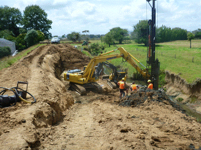 Maintenance works on Tarawhataroa stopbank, Awanui flood scheme, Kaitāia.
Erosion
Erosion hazard
There are many forms of erosion hazard; the most common in Northland include land instability, coastal erosion and river erosion.
There are four main types of landslide hazards in Northland; debris avalanche, earth flows, greywacke slips and unstable mudstone. The primary hazard mechanisms relate to the interplay of the underlying geology, steepness of topography and saturation of soils.
Coastal erosion relates to the retreat of coastal landforms, such as dunes or cliffs, caused by coastal processes such as waves and currents, or human intervention that may interfere with natural sediment supply. In many cases coastal erosion is an episodic process, with erosion occurring in defined ‘chunks', driven by storm events that generate large waves and sustained periods of elevated sea levels.
Bank erosion is the most common form of river erosion in Northland, and is exacerbated by deposits of sediment and debris that deflect flow onto banks. Other forms of river erosion include bed scour, where the river bed scores, which often occurs following the removal of meanders. Avulsion can also occur, which is where a river channel rapidly changes course to form a new channel. This form of erosion is particularly evident on alluvial and debris fans.
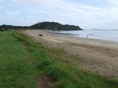
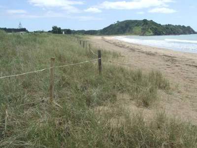
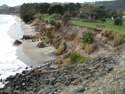 Coastal erosion increased by human intervention.
Erosion risk and consequences
The potential for erosion risk varies depending on the nature of the landform and the extent of human development or modification. For example, the landslide risk of shallow instabilities on steep hill country will often be increased as a result of the removal of native forest and conversion to pasture. In certain circumstances this type of conversion of land use has been demonstrated to have a negative economic benefit, due to soil loss affecting the productivity of the land.
Coastal erosion and river bank erosion can result in the need for costly erosion control measures to prevent the loss of property or assets. In certain circumstances the cost of controlling the erosion is beyond the means of the affected landowner, who may need to leave the land.
Erosion management
The management and mitigation of erosion hazard is addressed through a range of tools.
Soil conservation subsidies are provided through the Northland Regional Council Environment Fund to encourage landowners to plant poplar and willow trees to stabilise surface instability on hill country land or to control gully erosion or river bank erosion.
Geological mapping has been undertaken to categorise hazard profiles of land instability in certain urban areas, which is used in land use planning to identify development control and mitigation measures. Likewise, coastal hazard zones have been mapped based on the potential risk of shoreline retreat.
Monitoring assessment and risk reduction works are also undertaken on some areas of land instability to mitigate the potential threat to life and property. An example of this is the Bells Hill slip, which is located in Kaitāia above the Awanui River. Slope failure during a large flood event may cause significant flooding in Kaitāia. Regular geotechnical monitoring is undertaken of this slip to determine the rate of slip movement, and soil drainage and cut-off drains have been installed to minimise instability associated with soil saturation.
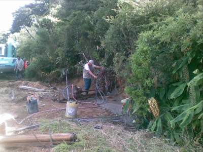 A drill crew installing horizontal drainage to reduce soil saturation and help mitigate instability at the Bells Hill slip, Kaitāia.
How are we measuring up against our objectives?
The following are the environmental results anticipated, listed in the operative Regional Policy Statement:
Increased public awareness of the risks of natural hazards and their exposure to them
• The general understanding of natural hazards has been improved through science that has assessed the ‘risk-scape' of Northland's natural hazards, based on the frequency of occurrence and consequence to better inform the potential risk.
• Some information about coastal and flooding hazards has been incorporated into district plans, and this information and information on other natural hazards has been published on publically accessible council websites.
• The regional council has initiated the Priority Rivers Flood Risk Reduction project, which is assessing and mapping flood risk for 27 priority catchments.
• Tsunami inundation and evacuation zone mapping has been undertaken for most of Northland's developed coastal areas. In addition, a number of communities in Northland have tsunami warning sirens.
A reduction in the damage caused to the environment by significant natural hazards
• The regional and district plan provisions assist to reduce the extent to which inappropriate development contributes to damage from natural hazards.
• River maintenance works and river schemes have been implemented reducing the risk of flooding and erosion.
• Soil conservation initiatives and subsidies are in place to help reduce sediment discharge to river systems and reduce the risk of hill country land instability.
A reduction in the damage caused to the environment by inappropriate protection works
• The Northland Regional Council has a full-time CoastCare Co-ordinator and an active CoastCare programme aimed at facilitating community-based restoration of dune systems as an alternative to other protection works. This programme provides for the mitigation of natural hazards, as well as restoring natural character and biodiversity of dunes.
• Resource consent is typically required for protection works, and assessment processes are in place to determine the potential damage to the environment from protection works before determining the appropriateness of the activity.
 Taipā beach before dune restoration work, May 2008.
 Taipā beach following dune planting and protection, February 2011.
What's being done?
• The regional council now has much better information on tsunami, coastal hazards and flooding hazard. This information is being passed on to district councils and needs to be used to inform and guide sustainable development with regard to understanding the potential risk associated with the hazard and either avoiding or mitigating risk to an acceptable level.
• There is a growing shift in focus from managing hazards through permanent engineering, to more proactive measures including land use regulation, community preparedness for and awareness of natural hazards, including active consideration of how and when managed retreat should be implemented.
• There is also a growing appreciation of the impact flood hazard engineering has on the wider environment. For example, the building of flood protection works along rivers means that less water and therefore sediment spills out onto the adjacent flood plains. This leads to increased sediment being deposited in estuaries. Nevertheless, the maintenance and improvement of existing flood management will need to be continued (until proven unsustainable), and in many situations additional engineering works will need to be undertaken to reduce risk in areas of existing development.
• Better integration of the management of the coastal marine area and adjoining land margins to better manage effects of activities, particularly coastal protection works, and avoid activities that exacerbate coastal erosion.
• Identification, protection and restoration of natural systems that are a natural defence to coastal erosion.
• The natural hazards policies in the proposed new Regional Policy Statement are more restrictive than what is currently in the operative policy statement. There are specific policies for new development within 10 year and 100 year flood hazard areas, and within coastal hazard areas, as well as general ‘risk management' policies. Applicants will need to demonstrate to councils that their developments in hazard prone areas will not pose undue risk to themselves or neighbouring properties.
• Territorial authorities will be required to incorporate maps into district plans and Northland Regional Council is also introducing a new method around minimum floor levels in the coastal environment (specifically to avoid risk from coastal inundation).
References
Beetham, R.D., McSaveney, M., Dellow, G., Rosenberg, M., Johnston, D. and Smith, W. 2004. A review of natural hazards information for Northland region. Report prepared by the Institute of Geological and Nuclear Sciences Limited for Northland Regional Council.
Northland Civil Defence Emergency Management Group. Northland Civil Defence Emergency Management Plan. 2010.