13.1 Introduction
The Ngawha geothermal field is located approximately 5 km east of Kaikohe. It covers an area of between 25 to 50 km2, and is the only high temperature geothermal field in New Zealand outside of the Taupo Volcanic Zone.
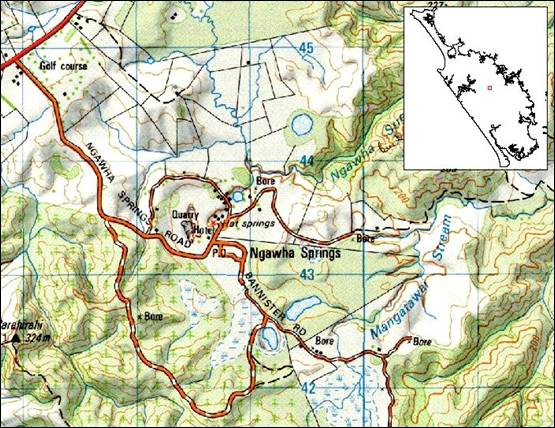
Figure 1: Map of Ngawha geothermal field.
The geothermal field lies within a small topographic basin and is centred on the town of Ngawha Springs. At the surface, the geothermal system consists of hot water springs and gas seepages. The productive reservoir consists of the permeable volume within the greywacke basement, which is thought to be more than 1000 m thick (Gibson 1992).
There are about 20 hot springs in the area, many of which are used as baths. Most of these occur in a small area in Ngawha Springs. They are a sacred taonga to the local hapu and all of Ngapuhi.
The waters in the springs are typically between 40 to 50°C, slightly acidic and give off a weak smell of hydrogen sulphide. The water chemistry includes high concentrations of boron, ammonia and bicarbonate, and mercury mineralisation. Given its water chemistry, and its geology, the Ngawha geothermal field is quite different to other geothermal fields in New Zealand.
The earliest phase of geothermal exploration at Ngawha concluded in 1964 with one deep bore being drilled (NG1) (Gibson 1992). The former Ministry of Works drilled more exploration deep wells from 1977 to 1983. Some characteristics of these wells are given in Table 1 (below).
Table 1: Characteristics of exploration deep wells drilled at Ngawha from 1977 to 1983 (Thain 1985)
| Year drilled | Well number | Total depth (m) | Maximum temp (ºC) | Flowing enthalpy (kJ/kg) | Flow rate (kg/s) |
| 1977 | NG2 | 1253 | 236 | 980 | 30 |
| 1981 | NG3 | 1470 | 228 | 980 | 30 |
| 1978/79 | NG4 | 1353 | 237 | 970 | 110 |
| 1978 | NG5 | 1281 | 250 | - | - |
| 1978 | NG7 | 1316 | 189 | - | - |
| 1982 | NG8 | 1184 | 218 | 890 | 65 |
| 1979 | NG9 | 1000 | 227 | 970 | 65 |
| 1981/82 | NG11 | 1209 | 225 | 960 | 90 |
| 1982 | NG12 | 658 | 229 | 980 | 105 |
| 1982/83 | NG13 | 2333 | 300 | 970 | 145 |
| 1982 | NG15 | 431 | 175 | - | - |
| 1982 | NG18 | 1362 | 244 | 950 | 30 |
| 1982 | NG20 | 1644 | 260 | 2000 | 13 |
Most of the wells were discharged and tested for short periods, but were then left virtually untouched for a decade, before the existing power development was proposed. Two new wells were drilled in 2007, which are not presented in this table.
Regional Policy Statement objectives
There are no objectives in the Regional Policy Statement (RPS) for Northland (NRC 2002a) specific to geothermal resources. However, the objectives pertaining to water quality and quantity (including lakes, streams and groundwater), land and biodiversity are all relevant to the Ngawha geothermal field.
For more information on these objectives check out the relevant sections of this report or the RPS which is available on the Regional Council website.
Issues relating to geothermal resources
The key issue relating to the geothermal field is how much geothermal fluid can be used for power generation without significantly affecting the existing geothermal springs in the Ngawha Basin and the surrounding environment.
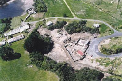
Maori and spa baths with Lake Tuwhakino at upper left. Photo courtesy of Tricia Scott.