Rainfall
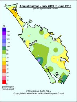
In 2009-2010, the annual rainfall for Northland varied from 51% to 106% of the mean annual rainfall for the region. Average rainfall was recorded in the high altitude areas of western Northland and below average elsewhere. Particularly dry areas included the far north peninsula, Hokianga, and eastern areas. The map below shows the annual rainfall recorded for Northland as a percentage of the mean annual rainfall.
Northland's climate in 2009-2010 was typically variable. Winter included heavy rain, severe winds, storm surges and flooding. Late spring to early autumn saw severe drought conditions with wet conditions returning from late autumn to the end of June.
The MetService provides Regional Councils with frequent warnings of adverse weather systems. During 2009-2010, seven severe weather warnings were issued. Three of these severe weather warnings produced significant flooding in the region. Other climatic events to affect the region during the year included, damaging winds, isolated thunderstorm activity, tsunami waves and a tornado in Kaitāia.
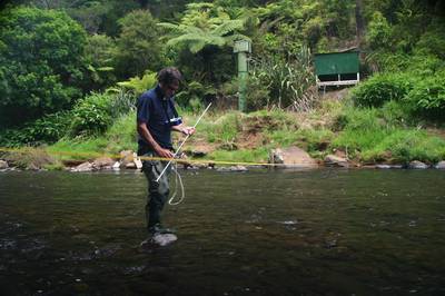
Photo: Northland Regional Council Hydrology Monitoring Officer Alan Bee conducting monitoring of the Kaihu River.