Location of incidents
The map below shows the distribution of incidents reported to the Council during 2009-2010. The greatest number of incidents was reported in the Whāngārei area – 346 in total. This is to be expected given the number of people living in the area, and the urban nature of the catchment. No incidents were recorded along the Far North and Kaipara coasts.
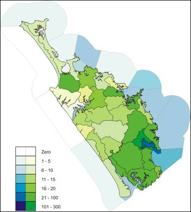
Map: Location of Incidents