Introduction
The Council monitors rainfall, river, groundwater, tidal and lake water levels through its hydrometric network, which consists of 211 monitoring stations spread across Northland. Of these stations, 81 are on a radio/cellphone telemetry network, which means that the data collected is automatically sent to the Council's computers for processing.
During 2008-09, three new stations were installed. These included two automatic rainfall stations and one automatic water level station.
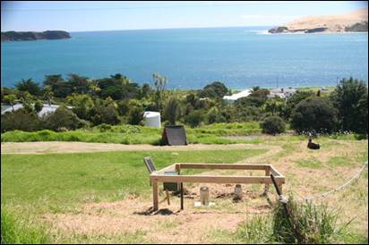
Photo: The new telemetered rain gauge at Omapere
Data collected from this network is used to report on Northland's climate, improve flood warnings and guide water management, particularly during drought conditions.
The Council is also using information collected through its monitoring programme to develop a water allocation framework for the region, which will ensure the sustainable management of Northland's freshwater resources.
All telemetered rainfall and river information is available to view on the Council's website - http://www.nrc.govt.nz/riversandrain Data is updated daily and the website allows everyone to view information on either a map or in table format.