What does the EMP monitor?
The Council's EMP follows a standard methodology, developed by the Cawthron Institute, used by a number of Regional Councils in New Zealand. This means that the data collected by the Council is scientifically sound and can be compared to results collected elsewhere in the country.
The programme involves identifying catchment land-use and possible inputs into each estuarine system; sampling the physical (sediment grain size) and chemical properties (nutrient and metal contaminants) of the sediment, and recording the animals (biological communities) and habitats within the intertidal habitat of each estuary in the programme.
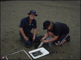
Photo: Regional Council monitoring staff take samples of one of the three estuaries monitored in Northland
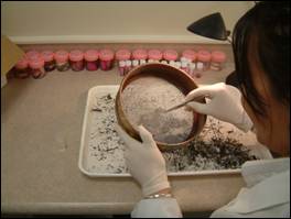
Photo: A Regional Council laboratory technician sorts sediment from an estuarine sample
In 2008, the Council monitored three Northland estuaries; the Whangarei harbour, the Kerikeri inlet and the Ruakaka estuary. These estuaries have been chosen based on the land-use and activities that occur in their catchments. The catchment of Ruakaka estuary is largely dominated by grazed pasture; the catchment of the Kerikeri inlet contains a large amount of horticulture and the catchment of the Whangarei harbour contains largely urban or industrial land-use.