Introduction
Northlands' coastline includes 14 major harbours, numerous smaller estuaries and extensive stretches of rocky and sandy open coast. Tourism in the region is centred on the region's beautiful coastline and internationally renowned marine environment. However, this coastal environment is under increasing pressure from human activity.
The Northland Regional Council (NRC) carries out considerable monitoring of the coastal environment in order monitor the current state of this resource, and changes over time. In 2004, the Regional Coastal Plan for Northland (RCP) became operative and this plan outlines the rules and regulations regarding what people can and cannot do in coastal areas, with regards to activities that may impact on the coastal environment.
In 2007-08, 44 popular coastal bathing sites were monitored through the Recreational Bathing Water Quality Programme. These sites were monitored for twelve weeks over the summer months. Water samples were taken from each site on a weekly basis and analysed for illness causing bacteria. Results for each site were then compared to water quality guidelines and each site was given a weekly grading depending on the results – green for ‘safe' for swimming, amber for ‘caution' and red for ‘unsafe' for swimming. For more information and for the results from 2007-08, refer to the Coastal Recreational Bathing Water Quality section of this report.
For 12 weeks over the summer months, NRC also undertakes water quality testing at a selection of coastal sites to assess their suitability for recreational shellfish gathering. During the summer of 2007-08, sampling was undertaken at a total of 15 sites. The water samples taken are analysed for levels of faecal coliform bacteria and the results are compared to guidelines issued by the Ministry for the Environment to determine if the sites are safe for shellfish gathering. For more information, go to Water Quality for Recreational Shellfish Gathering.
NRC is responsible for the administration and monitoring of approximately 133 marine farm resource consents in Northland. Visual inspections of the farms are undertaken by NRC staff on a biannual basis and each farm is graded according to compliance with the conditions of its resource consent. In 2007-08, 25 abatement (stop) notices were issued to farmers whose farms were found to be significantly non-compliant. In addition, NRC staff undertook monitoring of the six marinas in Northland to check compliance with the conditions of their consent.
In 2007-08, three estuaries – Whangarei, Ruakaka and Kerikeri – were surveyed as part of the Estuarine Monitoring Programme. For each estuary, three assessments were undertaken. The catchment land-use for each harbour was mapped to ascertain potential sources of contaminants, intertidal habitats were mapped using aerial photos and a biological survey was undertaken of the intertidal sand/mud flats of each site. Preliminary results indicate that these systems have been adversely impacted by human activity.
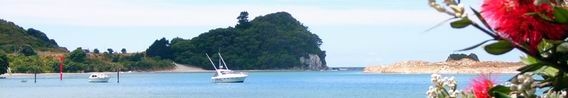
Photo: Mangawhai
Harbour water and sediment quality is also monitored by NRC in the Whangarei Harbour and Bay of Islands. In 2007-08, the monitoring programme was revised. The programme is now targeted at monitoring levels of contaminants in the fine sediments located close to urban and industrial areas, levels of bacteria in harbour waters, nutrient levels and sediment loading. During 2007-08, 32 sites were monitored, 16 in each harbour system. For more information, refer to the Harbour Water Quality and Sediment Monitoring section of this report.
With over 3000 kilometres of coast and 30 coastal settlements, Northland's exposure to tsunami hazard is high. In 2007-08, the National Institute of Water and Atmospheric Research (NIWA), commissioned by NRC, undertook a tsunami hazard assessment of Northland's coastline. The most likely scenarios for creation of a tsunami were used to model the predicted wave height and wave inundation at selected coastal locations in the region. The results were then mapped to show those locations most at risk from tsunami hazard.
The Beach Profile Monitoring Programme continued in 2007-08 to provide information on the stability (i.e. accreting (growing), equilibrium (staying the same) or eroding) of the foreshore and foredune at selected coastal locations in Northland. The general trend is for small losses or gains at most sites however significant erosion was experienced at Pouto and Omapere during 2007-08.
The NRC CoastCare Programme was established in 2005. The aim of the programme is to enable communities to better understand coastal processes and initiate protection, restoration and enhancement of dune ecosystems through the establishment and resourcing of community-based CoastCare groups. In 2007-08, there were over 20 community CoastCare groups registered with NRC. During the winter of 2008, these groups planted a total of 13,000 spinifex and 6,000 pingao plants, contributing towards the restoration of dune and beach systems across Northland.