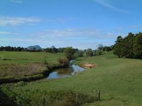
Waiotu River at SH1
The Waiotu River is a hard sediment bottomed river derived from a predominantly agricultural catchment. The river originates from hills to the northeast of State Highway one between Kawakawa and Whangarei, to eventually combine with the Whakapara River and form the greater Wairua River.
The 2004-2005 results for the Waiotu River site are summarised in the table below including the median, range and percentage of sampling occasions that comply with relevant guidelines for the 12 sampling occasions. Medians shown in red are outside the recommended guidelines.
| Parameter | Median | Range | % comply with guideline |
| Temperature (deg. cel.) | 15.5 | 11 - 20.9 | |
| Dissolved oxygen (mg/L) | 9.5 | 6.9 - 12 | 100 |
| Dissolved oxygen (% Sat.) | 93.7 | 75.6 - 109.5 | 8 |
| Conductivity (mSm) | 10.0 | 8.4 - 14.6 | |
| Water clarity (m) | 0.75 | 0.35 - 1.97 | 82 |
| Turbidity (NTU) | 9.2 | 3 - 25 | 25 |
| E. coli (n/100mL) | 370 | 74 - 3255 | 8 |
| Dissolved reactive phosphorus (mg/L) | 0.029 | 0.013 - 0.048 | 0 |
| Total phosphorus (mg/L) | 0.075 | 0.039 - 0.136 | 0 |
| Ammoniacal nitrogen (mg/L) | 0.025 | 0.005 - 0.15 | 50 |
| Total nitrogen (mg/L) | 0.685 | 0.216 - 1.09 | 25 |
| pH | 7.0 | 6.8 - 7.4 | 25 |
Water quality is highly impacted at the Waiotu River site, with the medians for the majority of parameters above not meeting their respective guidelines. Dissolved reactive and total phosphorus exceeded their respective ANZECC trigger values on all 12 sampling occasions.
The trend analysis suggests that there is a decreasing trend in ammoniacal nitrogen, nitrate/nitrite nitrogen (NNN) and total nitrogen and increasing trend in pH. These are all seen as beneficial trends; however caution should be taken as these trends are based on only six years data at this stage.
 Waiotu River.