Introduction
The Northland Regional Council operates a hydrometric network (refer page 2) consisting of river, groundwater, tidal and lake water level and rainfall stations throughout Northland. There are a total of 200 stations on the hydrometric network of which 63 are automated, while the rest are manually read. Of the 63 automated stations 39 (62%) are on a radio/cellphone telemetry network (refer page 5). These networks and the work of the Council's Hydrology team met relative performance targets (refer page 17) in 2005-2006.
In the 2005-2006 financial year two new telemetered water level stations were installed. These included one in the Kaihu River catchment at Parore to record flood levels and flows in the lower Kaihu River, and the other in the Victoria River catchment north of the Mangamuka Hills to enable flood modelling to be carried out for the Awanui River Management Plan as well as provide improved flood warning capabilities for Kaitaia.
From July 2005 to June 2006 thirteen severe weather warnings were issued, compared to a total of six warnings issued in 2004-2005. Three severe weather warnings produced significant flooding in various parts of the region.
For the Northland region the annual rainfall (refer page 7) totals for 2005-2006 varied between 78% and 130% of the mean annual rainfall. Compared to 2004-2005 where annual rainfall varied between 50% and 92%. The 2005-2006 annual rainfall patterns match very close to the expected annual rainfall amounts. There was a significant variability in climate conditions throughout the year. Major events throughout the seasons included; during winter high rainfall intensities from 32 to 53 mm/hr and dry conditions throughout August; during spring thunderstorm activity, hailstorms, gale force winds, stormy seas, flooding and low rainfall recorded during November; and during summer, heavy rain events during December and January and a dry February,
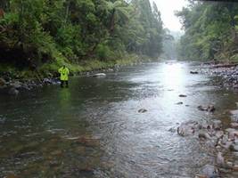
River flows (refer page 10) in 2005-2006 were characterised by below average monthly flows during August, September, November and December. Lower flows were recorded in the far north areas from November to February than elsewhere in the region. Near average to above average flows were recorded in July, October and January through to May.