BREAKING NEWS
Story
22 May 2024, 3:50 PM
Technology takes hydrology monitoring to new heights
Behind the data that informs a raft of critical environmental and emergency management decision-making about our river levels in Te Taitokerau is our dedicated hydrology team.
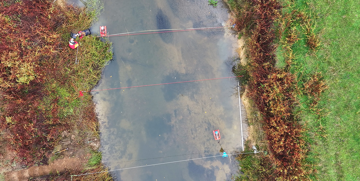
A drone's eye view of the tech and hydrology team in action.
The 10-strong hydrology team manages a network of around 120 hydrometric stations across the rohe that records continuous data 24/7 on river level and flow, rainfall, groundwater levels, tide levels, and soil moisture.
This isn’t just about keeping tabs on river levels and rainfall; it’s about ensuring that our data is top-notch. Why? Because this data helps us manage water resources, comply with environmental regulations, and protect our communities from flooding.
And thanks to a range of technology, we’re achieving things we couldn’t before.
Our hydrology team came together this week for a hands-on training day, focussed on learning to use advanced equipment for measuring high water flows during floods. This practical session was aimed at making sure our team can handle the equipment confidently and safely.
Our team now uses some pretty impressive tech like drones for river flow gaugings. It’s not just quicker, it’s a game-changer for reaching inaccessible places and flood gauging, and a major leap forward for health and safety.
Using STIV (Space Time Image Velocimetry) software, we transform the drone footage into valuable data, measuring the river’s surface velocity with precision. And when paired with a surveyed cross-section, we can calculate the river’s flow without setting a foot in the water.
Other technology we’re using includes flow trackers and Acoustic Doppler Current Profilers (ADCPs) that can be strung across rivers or mounted on remote-controlled boats.
Using these technologies means we’re gathering more precise data, and we’re doing it safely. And for everyone in Te Taitokerau, it means we have high-quality data to make informed decisions about our water resources.
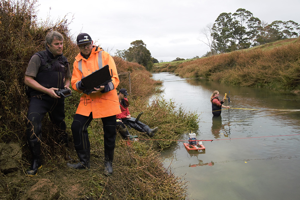
Members of NRC's Hydrology team testing exciting tech at their recent training day.
