Regionwide technical reports
The Region Wide Catchments reports explain the hydraulic modelling and output (flood maps) methodology. The reports provide a summary of the meteorological data collection, gauged hydrologic analysis and the development of the preliminary hydraulic models, including their calibration against past events. The report(s) have been peer reviewed by BECA Consulting Engineers.
- Ahuroa, North, Ruakaka and Waihoihoi catchments (PDF, 3.8MB)
- Aupouri Peninsula catchment (PDF, 3.0MB)
- Awanui catchment (PDF, 3.8MB)
- Bay of Islands Coast catchment (PDF, 3.5MB)
- Hakaru catchment (PDF, 4.0MB)
- Kaeo catchment (PDF, 3.9MB)
- Kawakawa catchment (PDF, 4.0MB)
- Lower Mangakahia catchment (PDF, 3.6MB)
- Lower Purua, Lower Wairua Bridge, Mangaharuru, Mangere Waipoa, Waiotu and Whakapara catchments (PDF, 4.2MB)
- Manganui catchment (PDF, 4.0MB)
- Northern Wairoa catchment (PDF, 3.8MB)
- Oakura catchment (PDF, 3.2MB)
- Omapere catchment (PDF, 3.7MB)
- Oruru catchment (PDF, 3.4MB)
- Pouto Peninsula catchment (PDF, 3.4MB)
- Waimamaku catchment (PDF, 3.1MB)
- Whangapae Ahipara catchment (PDF, 3.2MB)
- Whangarei catchment (PDF, 5.7MB)
- Whangarei Tutukaka Horahora catchment (PDF, 3.5MB)
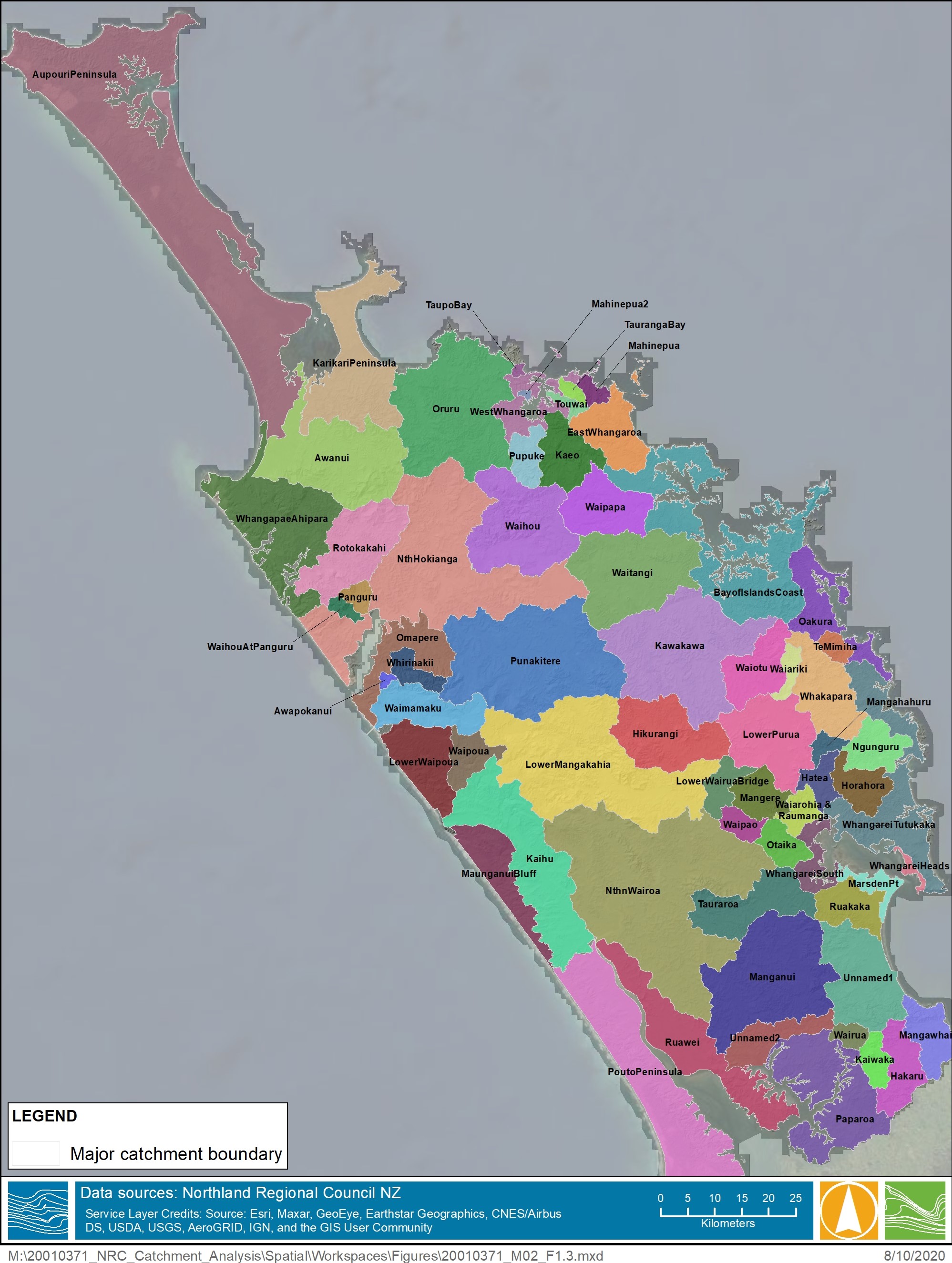
Map of Northland's catchments.