10.4 What is being done?
Policy documents
The Regional Policy Statement for Northland (NRC 2002a) sets out to provide an overview of the resource management issues of the region, and contains policies and methods to achieve integrated management of the region's natural and physical resources. In Northland there are many significant problems and potential conflicts between use, development and protection of the region's water resources.
The Regional Water and Soil Plan for Northland (NRC 2007) sets standards for allowing, restricting or prohibiting activities, and contains policies and rules that the Regional Council uses for deciding on applications for water-related consents. These include setting minimum water quality standards or minimum levels of water flows.
Water shortage and drought response guidelines
In response to a serious temporary water shortage in Northland the Council can issue a water shortage direction to allow continued water takes (pursuant to Section 329 of the RMA). Based on the current pattern of water use, the application of a water shortage direction to large areas of Northland at any one time is unlikely. It is most likely that the need would be confined to a few sub-catchments at any one time.
Compliance with resource consents, efficient use of water and voluntary reductions are important prerequisites to the implementation of a water shortage direction. Only when these are insufficient to prevent a severe shortage of water is a water shortage direction necessary. The maintenance of people's health is given the highest priority of water use.
The main policy on drought response emphasises the data collection network, publicity and early warning of potential drought problems. This includes the notification of pending water shortages and dissemination of information; modification of water use; and compliance.
Minimum flow criteria
There is currently no policy or objectives in our regional plans on the total maximum volume of water that can be allocated from water bodies in Northland. However there are policies relating to the maintenance of flows and levels in water bodies in section 9 of the RWSP.
Research has emphasised the need to maintain minimum flows that protect the functioning and non-extractive uses of rivers. These functions include the life- supporting capacity and waste assimilation potential of the water bodies and also meeting the needs of recreational, amenity and cultural uses.
Generally, smaller rivers are more sensitive to the potentially adverse effects of flow reduction on their life-supporting capacity than larger rivers. The mean annual low flow (MALF) is the flow required to be maintained in flow-sensitive rivers (rivers of high ecological value sensitive to the potentially adverse effects of flow reduction). The MALF is obtained by averaging the lowest daily flow for each year of record. This average estimates a natural minimum, which generally occurs in summer.
Minimum flow requirements, when MALF does not apply, are rivers or parts of rivers that are less sensitive to flow reduction and therefore lower minimum flows are acceptable to avoid adverse effects on the aquatic ecosystem. The continuous "7 day" one in five-year return period low flow is the flow required to be maintained in these rivers. The "7 day" value is used, as it is considered to be a more reliable and meaningful measure of flow. Table 17 in Appendix C shows the MALF and ‘7 day' one in five-year return period in various Northland rivers with a long-term record.
Hydrometric network
The NRC operates a hydrometric network consisting of 60 sites throughout Northland, which collect continuous data at intervals of between five and 15 minutes. This includes 30 river level sites, six tidal monitoring sites and 24 rainfall sites, as shown in figure 11 (below) and tables 18 and 19 in Appendix D. This is an increase of 20 automatic stations in the network since the last report (NRC 2002b). The hydrometric network also consists of 55 daily rainfall stations, operated by voluntary readers and 16 lake level sites recording monthly water levels. This network is also supplemented by five MetService automatic rainfall sites and seven NIWA sites (one rainfall site and six water level sites) collecting continuous five or 15-minute data.
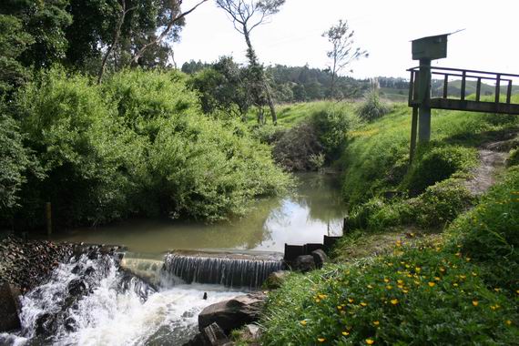
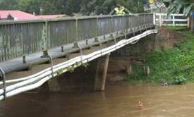
Ruakaka at Flyger Road.
Of the 60 continuous data recording sites, 54 are part of a telemetry system where data can be sent via radio or cellular phone to a base station at the NRC office in Whangarei. These telemetered sites provide a real-time picture of the state of the region's water resources, while the tidal station at Marsden Point acts as part of the Pacific Rim tsunami-monitoring network.
During periods of extreme rainfall, the telemetered sites play an important role, ensuring that both the Civil Defence and the general public are kept informed, via media releases, of flooding in Northland.
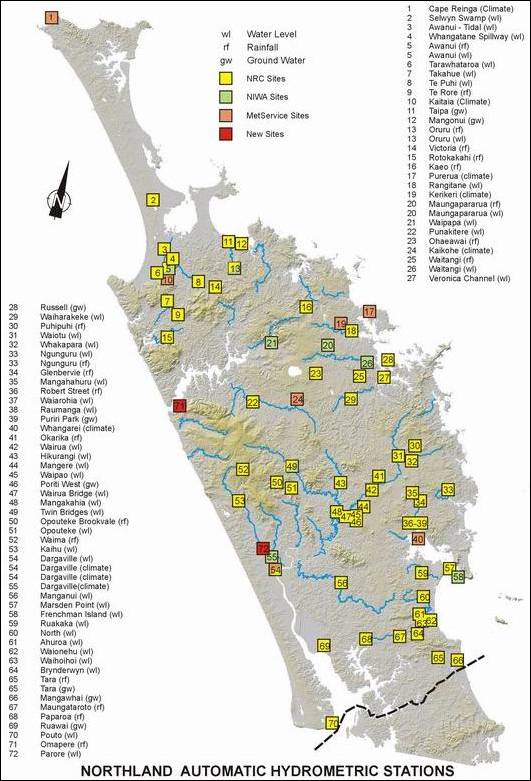
Figure 11: Water level, rainfall and groundwater sites on the automatic hydrometric network.
Flow gauge monitoring
During periods of drought, water levels are also monitored and when a low threshold is reached a low flow-gauging programme is undertaken in affected river catchments. These manual flow measurements enable the flow to be accurately determined and are used to monitor water usage. There are over 11,700 flow gauging records for 1,503 Northland sites held by the NRC. Since 2001, a total of 1,500 flow measurements were carried out, primarily for state of environment, consent compliance and flood monitoring.
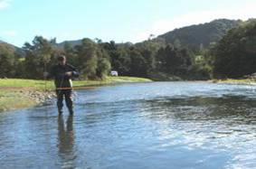
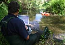
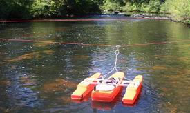
Standard method of low flow gauging on the Opouteke River using a mechanical flow meter (left) and low flow measurement using the ADCP and laptop on the Ahuroa River (right).
New flow measuring equipment has improved the council's ability to gather more accurate information on Northland rivers. The Acoustic Doppler Current Profiler (ADCP) is an electronic instrument that is used to measure water velocities and is transforming the way flow measurements in rivers are being carried out. The current methods of measuring flows with width measurement lines, current meters, sounding weights are fast becoming redundant. Data is transferred from the ADCP to the laptop computer via radio communications. The ADCP provides fast, accurate information resulting in more productive, diverse and cost effective river surveys; reduced lifetime equipment costs; and high quality data sets.
Old mechanical equipment being used for flood measurements on the Awanui River (left), and the use of the ADCP on the Punakitere River during elevated flows (right).