Lake Taharoa vegetation loss investigated
9 May 2023, 8:55 AM
Investigations are underway into the mysterious loss of most of the submerged vegetation in Lake Taharoa, the largest in the Kai Iwi dune lakes group and Northland’s deepest lake.
The last time the National Institute of Water and Atmospheric Research (NIWA) monitored the nationally significant dune lake for submerged plants in mid-2018 it received an ‘excellent’ ranking with a ‘submerged plant cover score’ of 87.2 percent. (Plant scores have been ‘excellent’ and stable since monitoring started in 2005.)
However, when the survey was repeated recently in March, that score had plummeted to just 1.8%, effectively meaning the lake – the second largest in Northland at more than 200 hectares – has lost nearly all of its submerged vegetation, earning it a ‘poor’ ranking.
Councillor Amy Macdonald, who chairs the Northland Regional Council’s Natural Resources Working Party, says efforts are now underway to establish what was behind the surprise drop.
“NIWA suggests a link with water clarity, declining water quality and very low water levels.”
In a recent update to the working party, the regional council’s Biodiversity Manager Lisa Forester, reported that at this stage it appears the devegetation had occurred relatively quickly; probably sometime over the most recent summer.
She says the council’s freshwater scientists had already investigated and reported on data around water quality and lake levels, but were unable to find a clear explanation for the vegetation decline. A report on the record low water levels in 2022 found that Lake Taharoa has little surface inflow and outflows with very small volumes of water taken for farm or human use. The lake has been losing more water to evaporation over the warmer summers than it has received in rainfall resulting in low water levels. The recent summer, although wetter than normal, has not been sufficient to top it up.
Ms Forester says further investigation is now required to fully understand the impacts of human activity and recent weather events on the lake.
A team of divers went into Lake Taharoa on Sunday 07 May to have a closer look at the lake bed. They were looking for clues to explain the loss in vegetation.
One theory is that strong sustained wind and rain during Cyclone Gabrielle may have eroded parts of the lake bed shelf, increasing sediment in the lake water, smothering lake bed plants and reducing water clarity.
Divers did see evidence of erosion and deposition, including newly formed troughs and bars, freshly deposited unstable sand, and debris from the land that has washed into the lake.
Ms Forester says for most of its life the 50,000-year-old lake had been surrounded by low fertility sand dunes and gumland scrub, however, that had changed in recent decades with the advent of farming, forestry and recreational use.
More work was needed to establish the relationship between the lake’s surface area and its volume including updating a water balance report that was done in 2014. Although the lake is up to 38-metres at its deepest point, there is a shallow shelf around its perimeter and much of this has been exposed in recent years due to dry weather.
Ms Forester says other considerations included the impacts of Cyclone Gabrielle – when large waves and some associated erosion of the lake edge were reported - and visitor usage, particularly over the busy summer months, including campers, powerboating, jetskis and swimmers. The council was also investigating reports of people washing vehicles in the lake.
The cumulative impacts of visitors, storm events, and low water levels (the lowest water level at Lake Taharoa since 1995 was recorded in May last year) all needed to be considered, along with surrounding land use activities.
Councillor Macdonald says next steps will include identifying information and analysing gaps and implementing annual testing for submerged plants in conjunction with existing weed surveillance.
Although other lakes nearby in the Kai Iwi group still had “excellent’ submerged plant cover scores at the time of the recent monitoring, council staff are carrying out checks of other lakes in the group to watch for any signs of decline.
Councillor Macdonald says the council is keeping its iwi partners Te Roroa and the Taharoa Domain Governance Committee up to date with developments at Lake Taharoa.
Te Roroa’s science advisor Taoho Patuawa says Te Roroa had been immediately informed of the situation and is concerned about the state of the lake.
“We’re committed to working with Northland Regional Council and other relevant parties to determine the contributing factors for this decline and investigate locally managed solutions to reverse this alarming result.”
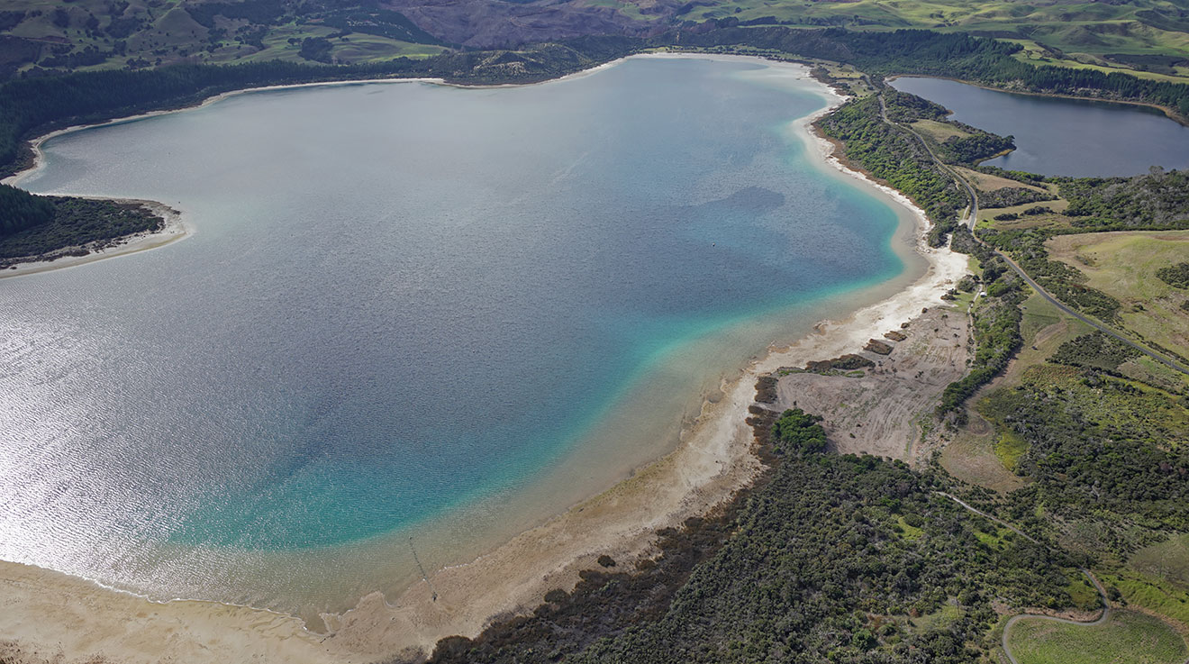
A file shot of Lake Taharoa from late 2021. The shallow shelf around the lake edge can be clearly seen in this image.