Drought firmly “locked in” in Northland
1 May 2020, 12:24 PM
Northland has been tipped into one of the most severe droughts on record and there’s no quick fix for the serious situation the region is in, according to the Northland Regional Council.
A burst of heavy rain is forecast for this weekend, followed by a return to dry conditions and cold southerlies next week. The rain will be welcome, but much more will be needed this winter to get the region back on its feet.
“A dry winter in 2018 preceded by a dry year in 2019 were the perfect set-up conditions for the drought currently gripping the region,” says Northland Regional Council’s Natural Resources Monitoring Manager Jason Donaghy.
“Storms and downpours are critical for the region this coming winter because this rain will determine how Northland’s rivers and aquifer copes with the following summer.”
The council is already urging people to think ahead to next summer and give thought to storage options such as tanks and dams to protect against possible acute water shortages again next year.
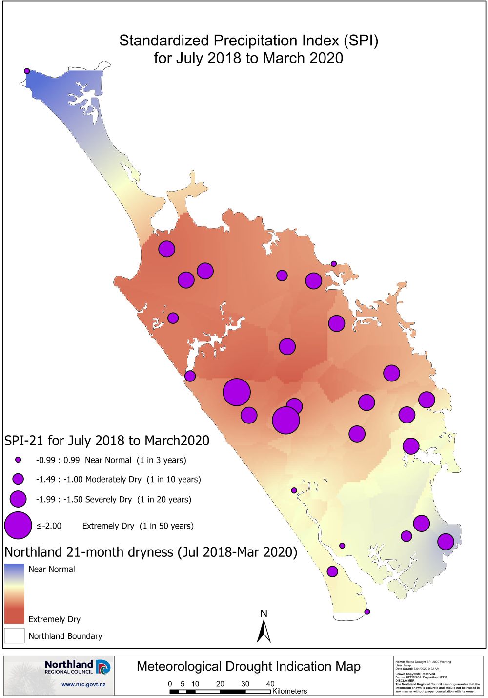
Council monitoring and hydrology team reports indicate that rain through March and April has helped the region slightly, with the drought intensity dropping from extremely dry, to severely dry, along the east coast and in the Far North.
Rainfall for this year is currently tracking 40 to 47% below normal levels across all the main centres in Northland. Generally, Whangārei would have about 365mm of rain “in the bank” by May each year, according to Mr Donaghy. “The total to date is well below this at only 140mm.”
By October 2020, rainfall totals will need to be at least 750mm along the west coast of the region and about 900-1000mm along the east coast and in the Far North.
Rivers are particularly low in Bream Bay, Whangārei and some of the Far North catchments with most rivers from 80% to 90% below normal flows throughout March 2020.
The Russell and Ruawai groundwater systems have begun to recover, while water levels across the small east coast aquifers are a “mixed bag”, with some recovering and others still decreasing. The Mangawhai, Poroti and Maunu aquifers are still declining.
This is because aquifers respond differently to drought conditions due to variables including land use, geology, soil, climate, recharge area, source, storage and abstraction rates. A shallow, sand aquifer reliant on rainfall will respond to reduced groundwater levels faster than a large aquifer system which will show a less immediate response to drought conditions.
Meanwhile, surface water flows and groundwater sources in Whangārei and Far North coastal catchments are at such low levels that serious temporary water shortages exist in many coastal aquifers. Restrictions (water shortage directions) are continuing with water use restricted to essential use only in the communities listed below.
People who have a critical need to take water and are unclear about whether they can do so under a water shortage direction should contact the regional council on 0800 002 004.
The coastal aquifers covered by the water shortage directions are:
Whangārei district - Ngunguru, Tutukaka, Matapōuri, Whangaumu Bay, Kowharewa Bay, Church Bay, Pataua north and south, Bland Bay, Ōākura, Teal Bay, Ngawai Bay, Moureeses Bay, Sandy Bay, Taiharuru Bay, Whananaki north and south, Woolleys Bay.
Far North district - Russell/Tapeka,Taipā, Coopers Beach/Cable Bay/Mangonui, Taupo Bay, Tauranga Bay, Matauri Bay, Te Ngaere Bay.
Further information
Download - MetService Four Week forecast for NRC 29 April 2020 (PDF, 1.2MB)