King tides Taitokerau
He Kaupapa mō Ngā Tai Nui o Te Taitokerau
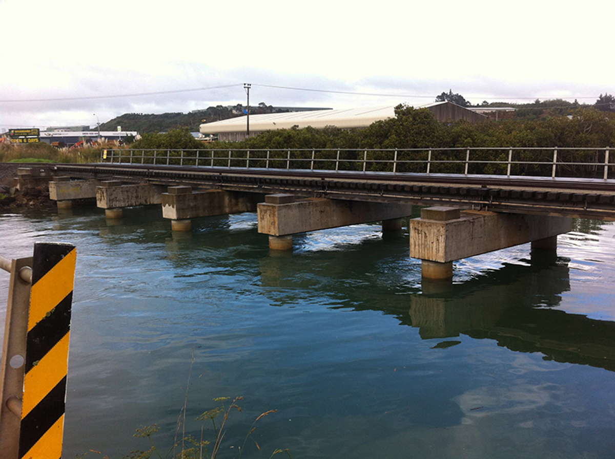
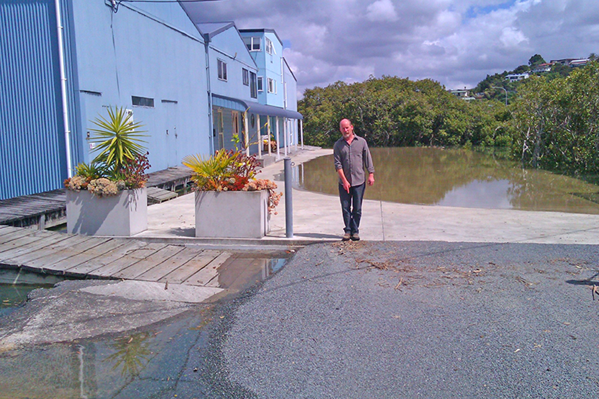
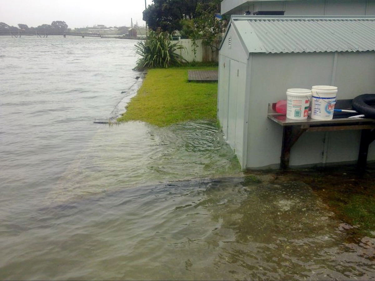
King tides give us a glimpse into the future of what Northland’s coastline may look like as a result of sea level rise.
This is because as sea levels rise, the highest high tides will become even higher and reach further inland. We want to understand how higher sea levels resulting from climate change could impact Northland’s coastline and sharing photos of local king tides will help understand and plan for this.

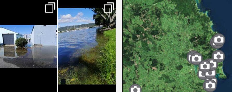
King tides Taitokerau map
Check out the king tide photos taken around Northland by our community of citizen scientists.
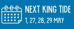
Keen to participate? Find out when the next king tide is on your coast and upload your shot.
Always consider your safety first. Remember, water levels during king tide events will be higher than normal, so take extra precautions on the coast especially if bad weather is also forecast.
Get involved
Citizen scientists have an important role to play contributing to data monitoring and collection programs. Empowering a team of motivated Northlanders to photograph the coastline during these events builds a useful, local pool of knowledge. Your photos may help us identify areas that are already at risk from higher water levels.
Getting involved is easy.
- Find out the date and time of the next king tide near you. See the calendar for when these tides are scheduled to happen in Northland.
- Visit your coast at that time and snapshot the tide at that moment. Get tips on how to get the best shot.
- Upload your photo: Submit your photo here.
- Share your photos on the socials using #kingtidestaitokerau. Tell your friends!
What is a king tide?
King tides are the highest high tides of the year. They are not caused by sea level rise but allow us to experience what higher sea levels will be like. King tides are a natural part of tidal cycles and occur over 3-4 days, several times during the year when there is alignment of gravitational pull between sun, moon and Earth. King tides are different to the more frequent "spring tides" in that they occur when the full or new moon coincides with the time when the moon is closest to Earth in its monthly orbit. Read more about spring tides.
When king tides occur during floods or storms, water levels can rise even higher and have the potential to cause great damage to the coastline and coastal property. Check out our Natural Hazards Portal for information on natural hazards in our region, including a specific section on coastal hazards and sea level rise.
Photographing king tide helps gain knowledge and understanding of the potential impacts of high water on local ecosystems, buildings, roads and other taonga. These photos will be used to:
- observe, visualise and understand the impacts of future sea level rise on coastal communities
- help document current coastal flood risks in coastal areas
- ground-truth and validate climate change models by comparing model predictions with the high-tide reality
- serve as a living record of change for future generations.
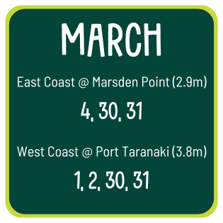
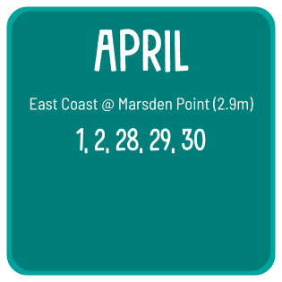
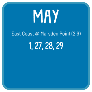
2025 King tides Taitokerau Calendar
Mark the next king tide in your calendar. Tidal height and times differ between coasts. You can find the exact tide time at your location by visiting Northland Tide Tables 2024-2025 and applying the secondary port adjustment.
For more information on why tides vary around New Zealand, visit the LINZ website for tide predictions.
Download and print these 2025 king tide dates for easy reference while you're out (PDF 385 KB)
How to get the ‘shot’
- A mobile phone is fine to capture a photo on, and you can also upload it there and then to the website.
- Focus on featuring a reference point such as bridges, jetties, large trees, drains and roads alongside the water level.
- Take a look at low-lying areas you know are already prone to coastal flooding.
- Focus on beaches, estuaries and river/stream mouths and keep an eye out for erosion or waves reaching places it doesn’t usually get to.
- Please make sure your safety comes first when taking a photo. Remember “Nobody’s stronger than Tangaroa”. Keep a safe distance and an eye out for large waves, slippery surfaces and higher than normal water levels.
-
Please also don't disturb shorebirds that may be much farther inland than usual, and always, keep off the dunes.