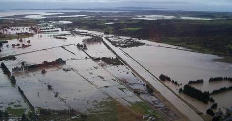
16.6 Case study 1 – Awanui River Flood Management Plan
The Awanui River Flood Management Plan has been developed over many years. Works in the early 1900s focused on bringing land near the harbour into production by preventing tidal flooding by salt water. Stopbanks and floodgates gradually extended upstream to provide flood management for more productive floodplain land. The flood of 1958, which flowed through urban Kaitaia, prompted a comprehensive upgrade to the scheme. Stopbanks were constructed around Kaitaia and the Whangatane Spillway was enlarged.
In 2005 the responsibility for the scheme shifted from the Far North District Council to NRC. At this time, the flood control scheme provided protection to the urban areas of Kaitaia and Awanui from an estimated one in 30-year flood.
After extensive consultation, the Awanui River Flood Management Plan was formally adopted by the Council in April 2005.
As part of this Plan, the Council intends to restore the scheme to its "as built" (1976) state over the next six years, restoring flood protection levels to a one in 100-year flood for the urban areas of Kaitaia and Awanui, and to a one in 20-year flood for the rural areas downstream of Kaitaia.
Since then, significant channel works have been undertaken to increase the capacity of the scheme, hydraulic modelling of the scheme has commenced, and telemetry water level and rainfall gauges have been installed to provide a better warning system for events affecting the scheme.
Large areas of highly productive land and the Kaitaia and Awanui townships now benefit from a significant level of reduction to the flood hazard present on the Awanui River flood plain.