11.4 What is being done?
Policy documents
One of the main objectives for groundwater management in Northland is the sustainable use and development of Northland's groundwater resources while avoiding, remedying or mitigating adverse effects on groundwater quantity and quality. The Regional Water and Soil Plan (RWSP) (NRC 2007) recognises 43 aquifers, and a geothermal aquifer as potentially ‘at risk' due to water demand, surrounding land use, surface water interaction or proximity to seawater and septic tank discharges.
The rules in the RWSP restrict groundwater takes, use, diversions and drilling activities depending on the potential effects of the activities.
The rules permit groundwater takes for reasonable stock and domestic requirements provided specific criteria are met. The criteria, amongst other things, limits the daily permitted groundwater take depending on the location and the potential for adverse effects as a result of the take. For example smaller volumes are permitted to be taken from coastal ‘at risk' aquifers. In the event the permitted criteria specified in the rules can not be met then resource consent to take groundwater is required from the Regional Council.
 Installation or alteration of a bore that is not temporary in nature (i.e. back filled within 14 working days) also requires resource consents.
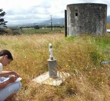
Right: Bore construction compliance check.
Monitoring
Resource consents to take groundwater, and drill a bore are subject to specific conditions. These conditions are imposed to avoid and/or minimise the potential adverse effects as a result of the activity. Monitoring the exercise of resource consents is carried out to ensure the conditions are complied with and the bore construction activities do not result in adverse effects on the environment.
Monitoring of the general state of the groundwater resources in Northland also occurs. The primary aims of the state of the environment groundwater monitoring is to gain a regional perspective on:
· Baseline water quantity and quality of different aquifers.
· Trends in groundwater quantity and quality over time as a result of climate, land use and groundwater abstraction.
Monitoring also ensures the management of the groundwater resources in Northland is sustainable and consistent with the objectives and policies of the Regional Policy Statement and Regional Plans.
The results of resource consent and the state of the environment monitoring can provide information on which to base future management decisions. In the event of groundwater monitoring highlighting issues in particular aquifers, specific investigations are initiated.
Groundwater quality monitoring
The National Groundwater Quality Monitoring Network was established in 1996 to gain an understanding of seasonal and long-term variation in groundwater quality. This network initially consisted of seven sites in Northland sampled on a quarterly basis. These sites are located in the areas of Houhora, Paparore, Ahipara, Kaikohe, Tutukaka, Whangarei and Tara. The samples are analysed for major cations, anions, nutrients and minor elements such as iron and magnesium.
The Northland groundwater quality network has been extended over the past five years to gain a greater knowledge of groundwater quality throughout the region. The network currently includes an additional 32 sites sampled quarterly, shown in table 8 (below). Twenty-two of these sites are located in coastal aquifers, which are analysed for saltwater and bacterial indicators every six months and chemical properties (the same set as for the national programme) on the sampling runs in between. Groundwater levels are also recorded at each site, where access is available. The remainder of the sites are located in basalt aquifers, which are sampled quarterly for a full range of determinants.
Table 8: Additional groundwater quality sites added to seven initial network sites since 1996.
| Coastal | General |
| Ruawai | Maunu Basalt |
| Mangawhai Heads east | Whatitiri Basalt |
| Mangawhai Heads west | Three Mile Bush Basalt |
| Mangawhai Village | Matarau Basalt |
| Sandy Bay | Glenbervie Basalt |
| Taupo Bay | Kerikeri Basalt |
| Tauranga Bay | Maungakaramea Basalt |
| Te Ngaire Bay | Tara Basalt |
| Tapeka Point | |
| Pataua Bay | |
| Whananaki Bay | |
| Taiharuru Bay | |
| Ngunguru | |
| Whangaumu Beach | |
| Matapouri Bay | |
| Oakura Bay | |
| Bland Bay | |
| Russell | |
| Cable/Mangonui Bay | |
| Coopers Beach | |
| Taipa | |
| Waipapakauri Beach | |
| Waipapakauri East | |
| Houhora |
Groundwater level monitoring
Groundwater level monitoring has been undertaken in the Northland region since the mid 1970s. Since that time the network has been developed in response to the identification of groundwater issues.
Groundwater level monitoring is currently undertaken in all of the principal aquifer systems in the Northland area. Levels are monitored at eight sites by automatic recorder and manually at a further 77 sites (of which 33 sites are monitored quarterly and 44 monthly). The monitoring wells have been selected to provide regional coverage and target-specific environmental concerns.
The groundwater level sites at Russell, Poroti West, Puriri Park, Ruawai and Tara are now telemetered to provide real time data, which is valuable for monitoring water availability in areas of high demand or aquifers at risk of saltwater intrusion.
Specific groundwater investigations
A number of investigations have been carried out as a result of specific issues arising in an aquifer. These investigations include the assessment of hydrogeology of the Three Mile Bush, Glenbervie, Maungakaramea, Kaikohe, Aupouri, Coopers Beach and Mangawhai aquifers. Additional groundwater quality investigations have been carried out in Ruawai, Russell and Taipa aquifers.
Due to the lack of recent groundwater information for the Oakura and Matapouri aquifers, specific groundwater investigations are in progress. These investigations will gain information on the current sustainable allocation for these groundwater resources and the current groundwater quantity and quality information.