Groundwater Quantity
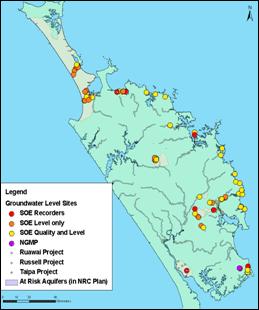
Monitoring groundwater levels provides information on the effects of climate, land use and abstraction on groundwater resources, and can tell us how much groundwater is available for use. The Council undertakes this monitoring through a region-wide network of hydrometric stations. Levels are currently recorded continuously at nine sites, monthly at 28 sites and quarterly at 29 sites. The location of groundwater level monitoring sites is shown on the map below.
In 2008-09, groundwater levels were found to be at or above average compared to historic levels. These levels were the result of just above average rainfall for Northland.
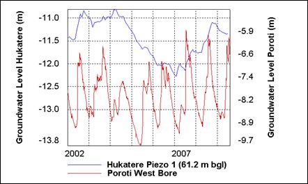
The results of groundwater level monitoring for two sites from 2002 to July 2009 are shown in the graph below. These sites are located in two different aquifers and respond differently to rainfall recharge. Poroti west bore is located in the fractured basalt aquifer which shows a strong seasonal rainfall recharge response. Hukatere piezo is a multilevel piezo located in the Aupouri sand/shellbed aquifer. This aquifer buffers seasonal variations and shows long term rainfall variations with only minimum seasonal change.