Estuarine Monitoring
Within this section…
Introduction
Estuaries are highly important ecological habitats. They are incredibly productive and support a large number of plant and animal species. Estuaries are also important economic, social and cultural assets. Harbour and estuarine systems in Northland, such as Whangarei Harbour and the Bay of Islands, contribute significantly to the region's economy and its natural value.
Northland's estuaries have been heavily modified and impacted by human activity over the last century. The impacts of human activity include sedimentation and nutrient enrichment of estuarine systems from land clearance activities and poor land management, and heavy metal contamination from industrial and urban development.
In order to monitor the health of Northland's estuaries, and record change over time, NRC implements an estuary monitoring programme (EMP). The monitoring programme has evolved from the Estuary Monitoring Protocol (Robertson et al 2002) developed by Cawthron for Regional Councils. The results from the programme will identify significant environmental issues and provide scientific information to enable people to make informed environmental management decisions.
The programme currently focuses on estuaries located in areas of significant economic growth and development or areas where there are specific environmental concerns. Monitoring has already begun in the Whangarei harbour, Kerikeri inlet and Ruakaka estuary. In 2008-09, sites in the Whangaroa and Kaipara harbours will be added to the programme.
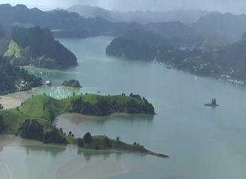
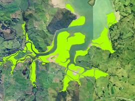
Photo: Whangaroa Harbour
Methodology
The EMP involves three assessment strategies:
- Identifying the catchment characteristics (such as land-use) and identifying potential inputs into the estuarine system;
- Fine-scale habitat assessment of the intertidal zones; and
- Mapping of key intertidal habitats.
Catchment Assessment
Catchment assessment involves looking at the land use and physical characteristics of the catchment that feeds each estuarine system, using computerised mapping (GIS) software. From this information, activities and practices that may affect estuarine health can be identified.
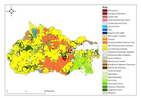
Map: Land-use in the Kerikeri catchment
Habitat Assessment
Fine-scale habitat assessment involves monitoring the biological community (plants and animals) and the physical and chemical characteristics of the sediments at permanent sites located in the intertidal sand/mud flats of each estuary. Once this baseline data has been collected, it is possible to monitor change in nutrient levels, metal contamination and community characteristics over time.
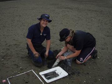
Photo: Regional Council staff undertaking sediment sampling
Monitoring undertaken at each site includes:
- Sediment core profiles – these show changes in the sediment over time;
- Analysis of sediment cores - looking at sediment grain size, nutrient levels and metal contaminants;
- Percentage cover of macroalgae on the surface of the sediment; and
- Identification and abundance of bottom-dwelling (benthic) animals.
Habitat mapping
Habitat assessment involves mapping key habitats, such as mangrove forest, sea grass beds and saltmarsh habitats, using both aerial photographs and field based surveys. This information is used to monitor changes in the distribution and extent of key habitats over time.
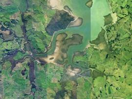
Photos: Digitalisation of mangrove habitat in the Mangapai River, Whangarei Harbour
Results 2007-08
Preliminary results from the three estuaries sampled during 2007-08 indicate that the biological communities (plants and animals) have been adversely affected by human inputs into these systems. At several sites, nutrient and metal contaminant levels were found to be elevated and evidence was found to suggest that sedimentation has had an impact on community health.
Further analysis of the results will be undertaken and incorporated into a technical report. In addition, future monitoring of these, and other estuaries in Northland, will further complete the picture of the current state of the region's estuarine systems.