BREAKING NEWS
Story
19 Sep 2025, 10:11 AM
Protecting Īnanga Spawning Sites in Te Taitokerau
Northland Regional Council has developed a new interactive map that identifies possible īnanga spawning sites in Te Taitokerau. This tool will contribute to work across the region to protect īnanga and preserve freshwater habitats.
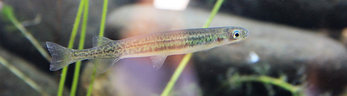
Īnanga are the smallest whitebait species, growing to around 11cm, and recognised by their silvery bellies and lack of scales. They are found in lowland freshwater areas including estuaries, streams, rivers and wetlands. In Te Taitokerau, they spawn in autumn and through winter.
Īnanga populations are in decline and the species is classified as At Risk. One of the biggest threats they face is a lack of spawning habitat through changes in land use and loss of wetlands.
Spawning occurs where spring high tides meet freshwater. The īnanga lay their eggs in vegetation on land, high up on riverbanks and above the normal flow level.
When wetland areas with native grasses are scarce, īnanga are forced to spawn in less suitable habitats, like main river channels, and without the protection of wetland grasses. This leaves their eggs vulnerable to predators like rats and mice.
By protecting spawning sites, we can help īnanga numbers recover and support other species that share these habitats, like eels, smelt and other types of whitebait.
If you have freshwater habitats on your property, make sure you’re aware of the rules in our Regional Plan to protect īnanga spawning sites:
- All livestock, including sheep, must be excluded
- Land drainage and flood control are not permitted between 1 March and 30 September, when īnanga are spawning
- Earthworks and land preparation may not occur within 10 metres of the spawning site.
If you can’t meet these standards, you will need to apply for a consent.
Check our indicative īnanga spawning map to see if there could be spawning sites on your land.
For more information and other ways you can help:
- Farmers Hub: Fish passage and īnanga spawning information
- Our information sheet: Where are our īnanga? (PDF 1.38MB)


