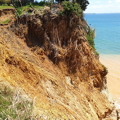
Hazard maps
Using new aerial survey data, we have updated coastal hazard maps and extended mapping into other areas. This means new properties at potential risk have been identified.
The maps show areas that may be prone to coastal erosion and coastal flooding over 50- and 100-year timeframes. They replace the previous flood susceptible layers in our online mapping and are in addition to the ‘Priority Rivers’ flood maps we already have.
The new region wide river flood maps allow us all to understand the risk areas and potential impact on Northland communities.
The maps are developed in line with best practice and modern techniques, using expert practitioners and the best information available.
They are used to inform decision-making to minimise the risks of coastal hazards – for example, district councils are required to use them to manage where and how development occurs.