About our region
Want to learn more about the place we call home? Find facts and figures about our environment, people, districts and economy.
More information about Northland's economy, infrastructure, people, culture and environment is also available in the About our region section of our Long Term Plan.
Our environment
Rich in culture and history, our region boasts a stunning natural environment north of our boundary line that stretches from south-east of Mangawhai across to the Kaipara Harbour and all the way up to New Zealand's northernmost tip, Cape Rēinga.
As the northernmost and warmest of New Zealand’s 16 regions, Northland is known as the 'winterless North'. The low elevation and close proximity to the sea result in a mild, subtropical and rather windy climate. Our region is a combination of natural taonga such as golden beaches, secluded coves, breathtaking seascapes, ancient forests, and a rich tapestry of flora and fauna.
Our natural taiao (world) is truly outstanding. Northland has more than 3,000km of coastline, 1.25 million hectares of land, excellent air quality and an abundance of freshwater. However, the region’s environment is fragile and always at risk. Our priority is to protect our natural environment by working closely with landowners, tangata whenua, community organisations and government agencies.
Land area: 13,940 km2
Highest point: Te Raupua - 781 metres above sea level
Coastline: 3200 kilometres in length
Largest lake: Lake Ōmāpere
Longest river: Northern Wairoa River
Number of harbours: 10
Find out more about our natural resources
Our people
Northland was originally home to some of our country's first human inhabitants. Today, it is one of the fastest growing regions in New Zealand and home to more than 190,000 people.
Estimated resident population:
Northland region
- 191,100
By district
- Far North: 71,000
- Kaipara: 24,100
- Whangārei: 96,000
Ethnic groups (includes people who may have selected more that one ethnic group), total people stated 179,076
- European or Other ethnicity (including New Zealander): 133,095
- Māori: 64,458
- Pacific peoples: 7,542
- Asian: 7,041
- Middle Eastern/Latin American/African: 900
Source: Statistics New Zealand Census 2018 data
Find out more: www.stats.govt.nz
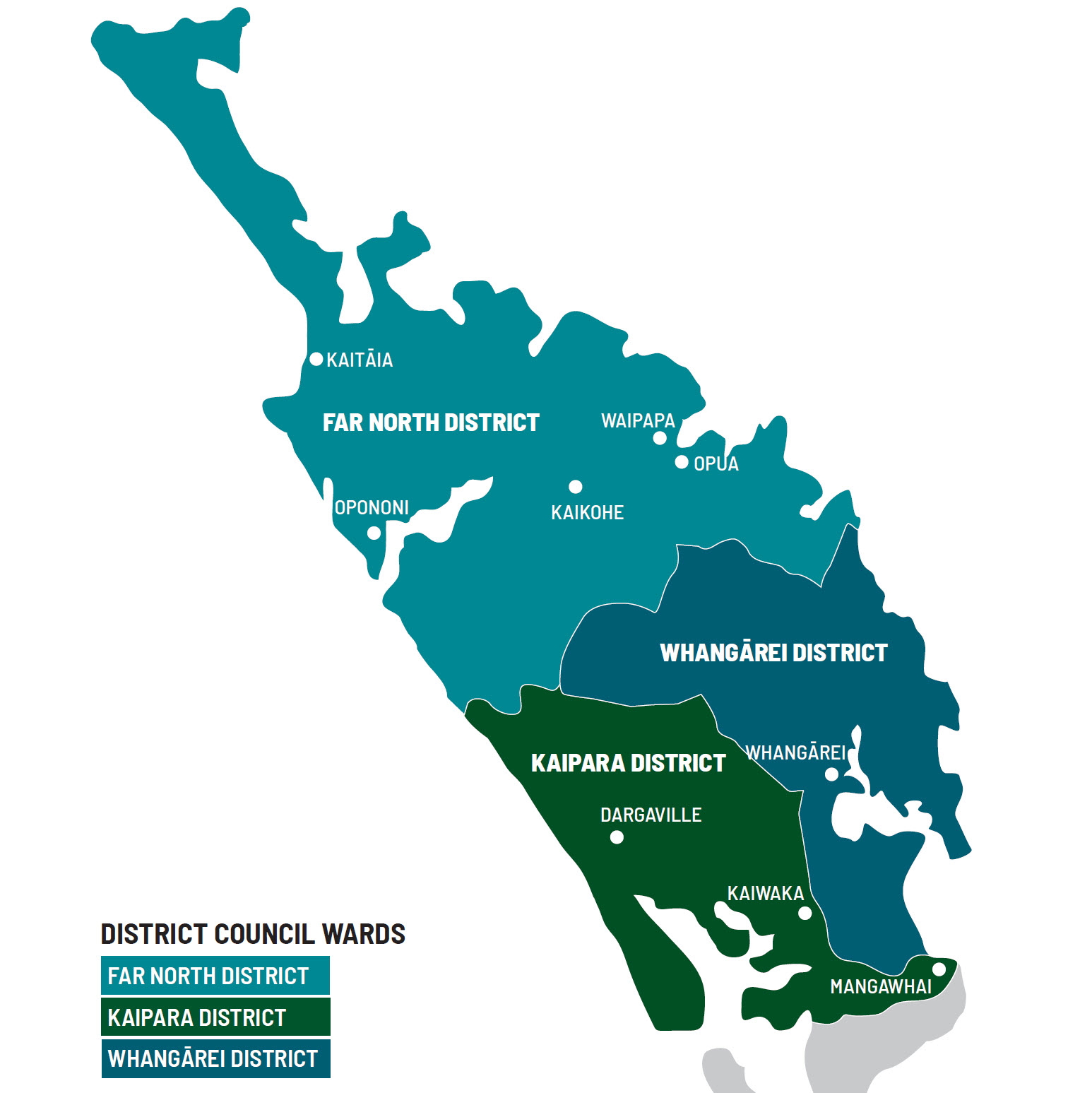
Three diverse districts make up the region of Northland:
- Far North
- Kaipara
- Whangārei
Go to our online map to see Northland's district boundaries in more detail
Find out more about our districts by visiting each district council's website:
Far North District Council
www.fndc.govt.nz
Kaipara District Council
www.kaipara.govt.nz
Whangarei District Council
www.wdc.govt.nz
Our economy
Northland has a diverse economy with manufacturing as our largest industry followed by agriculture, forestry and fishing, then business and property services.
For more information about the Northland economy visit our Regional Economic Development Agency - Northland Inc's website.
Our climate and weather
Northland, with its northern location, low elevation and close proximity to the sea is characterised by a mild, humid, and rather windy climate.
For more information about Northland's climate and weather, read the National Institute of Water and Atmospheric Research (NIWA) report The Climate and Weather of Northland in our resource library.